You can download the following files:
Scope and Objectives: Governmental authorities, policy makers, land managers and livestock farmers have to take decisions about sustainable pasture management
according to the rangeland productivity and status. However, collecting field data regarding the current condition of vegetation (plant cover, forage production) is time and
labor intensive leading to lack or discontinuity of data and information and thus, pastures are degrading having direct impact to rural societies.
Addressing activity line 6 "Earth Observations (EO) for Sustainable Development" of the ESA/AO/1-9101/17/I-NB call topic, SenSPa will foster the introduction of a new EO
application concept and a EO based tool for stakeholders and users supporting sustainable pasture management in developing countries. SenSPa aims to
demonstrate the use EO in pasture management and to develop an innovative EO application for sustainable pasture management. The information will be made
available via a web-based tool for sustainable pasture management that will be tested in a use case in Azerbaijan. The implementation of SenSPa will achieve
the following Scientific Objectives (SO):
SO1
Develop the necessary infrastructures for supporting automated satellite data acquisition, pre-processing and processing of satellite (Sentinel-2) imagery for pasture
monitoring
SO2
Deliver a cost-efficient, marketable web-based service using up to date satellite information to support sustainable pasture management.
SO3
Demonstrate and verify the added value, flexibility and adjustability of the SenSPa services at regional scales and highlight the expected societal benefits
of SenSPa application in developing countries.
SO4
Develop a methodological approach for modeling and assessing grassland productivity, rangeland condition and grazing capacity.
SO5
Engage stakeholders and promote the use of the SenSPa tool.
Concept: SenSPa will establish the necessary infrastructures for supporting automated satellite data acquisition, pre-processing and
processing of satellite (Sentinel-2) imagery for pasture monitoring. The SenSPa back-end will be customized on GMV’s EOMERLIN platform
back-end architectural design. The operational deployment of the solution will consider to transfer the processing to a platform such as the Copernicus Data and
Information Access Services (DIAS).
Sentinel images will be utilized to derive specific indicators that are used for vegetation monitoring and combine them with other ancillary data (soil maps,
elevation data, livestock farming and farm data, etc.) in order to assist sustainable pasture management, decision making, planning of activities and in the long-term pastures’
restoration. The information will be available to local and national public administrations, public and private stakeholders, as well as end-users, via the SenSPa
front-end, a web-based tool that will be processing continuously updated satellite data along with ancillary data in order to
provide useful, up to date information for sustainable pasture management.
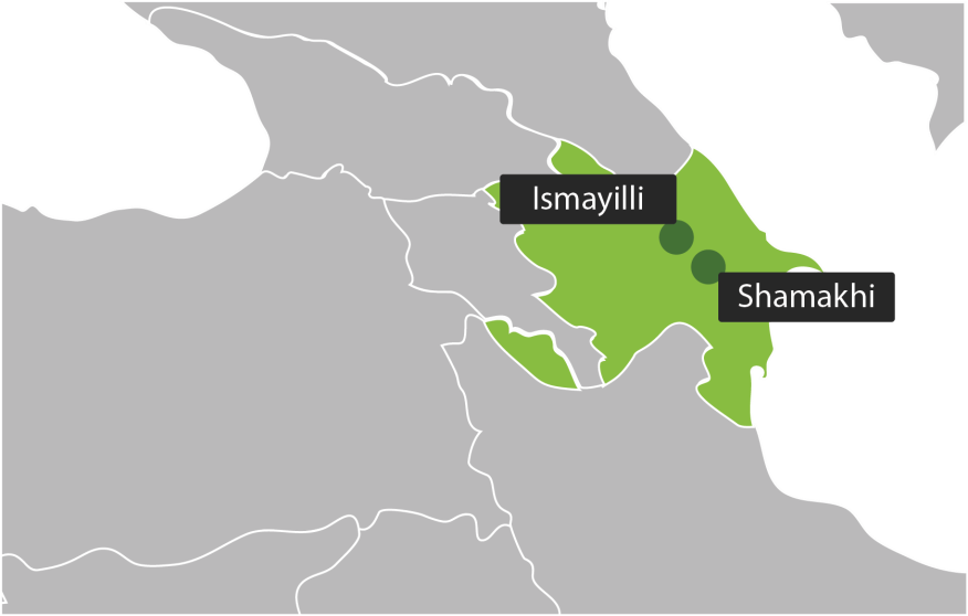
In the two case study areas (Ismayilli and Shemakhi rayons, Azerbaijan), field measurements will be conducted during two periods. These
measurements will include plant cover, floristic composition, and forage production, and will be used for model development and validation. Models based on
state-of-art techniques will be developed to estimate grass productivity and condition assessment based on a training sample from field measurements.
Original bands and indices from Sentinel-2 images will be linked with in-situ measurements of pasture/grassland productivity. Both simple (i.e. linear regression)
and advanced predictive models based on machine learning techniques will be employed. Accordingly, models will be validated using ground-truth measurements
independent from the training sample used in the model development.
Last but not least a plethora of Dissemination, Communication and Exploitation activities are foreseen in order to facilitate and boost stakeholders'
engagement and active involvement in the project activities and support the efficient dissemination and uptake of the project results.
Users' Needs: SenSPa will address the needs of Governmental authorities, local administrations, public and private stakeholders and farmers/pastoralists
regarding efficient monitoring and sustainable pasture management. Nowadays, there is lack in such technology. These stakeholders will be provided with
sound and up-to date evidence on the pastures status to reinforce decision making and planning mechanisms.